Major Winter Storm Set to Hit Manitoba with Heavy Snow, Freezing Rain and Travel Disruptions
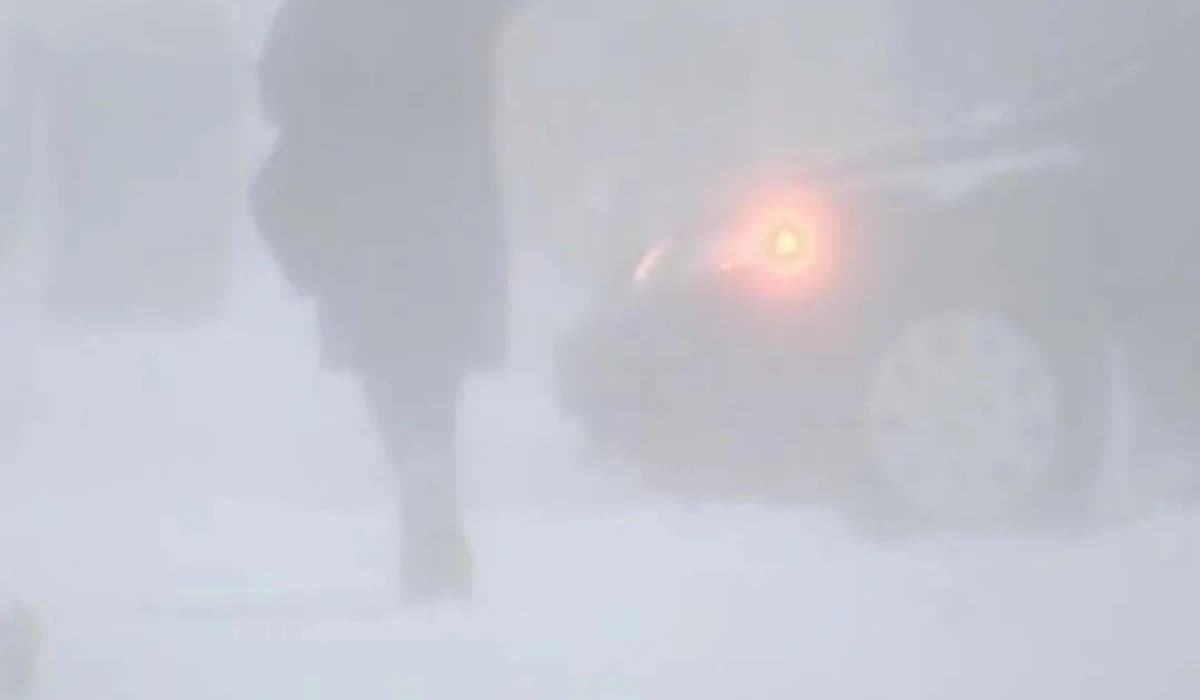
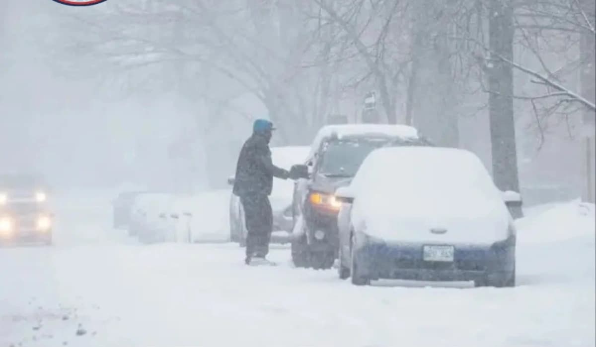
A powerful winter storm is expected to impact Manitoba this week, bringing a mix of freezing rain, heavy snowfall, and hazardous conditions. Northern regions could see up to 50 cm of snow, while central areas face icy roads and potential power outages.
Rochelle Silver
A significant late-season winter storm is set to sweep across Manitoba, bringing a powerful mix of freezing rain, heavy snowfall, and hazardous travel conditions over the coming days.
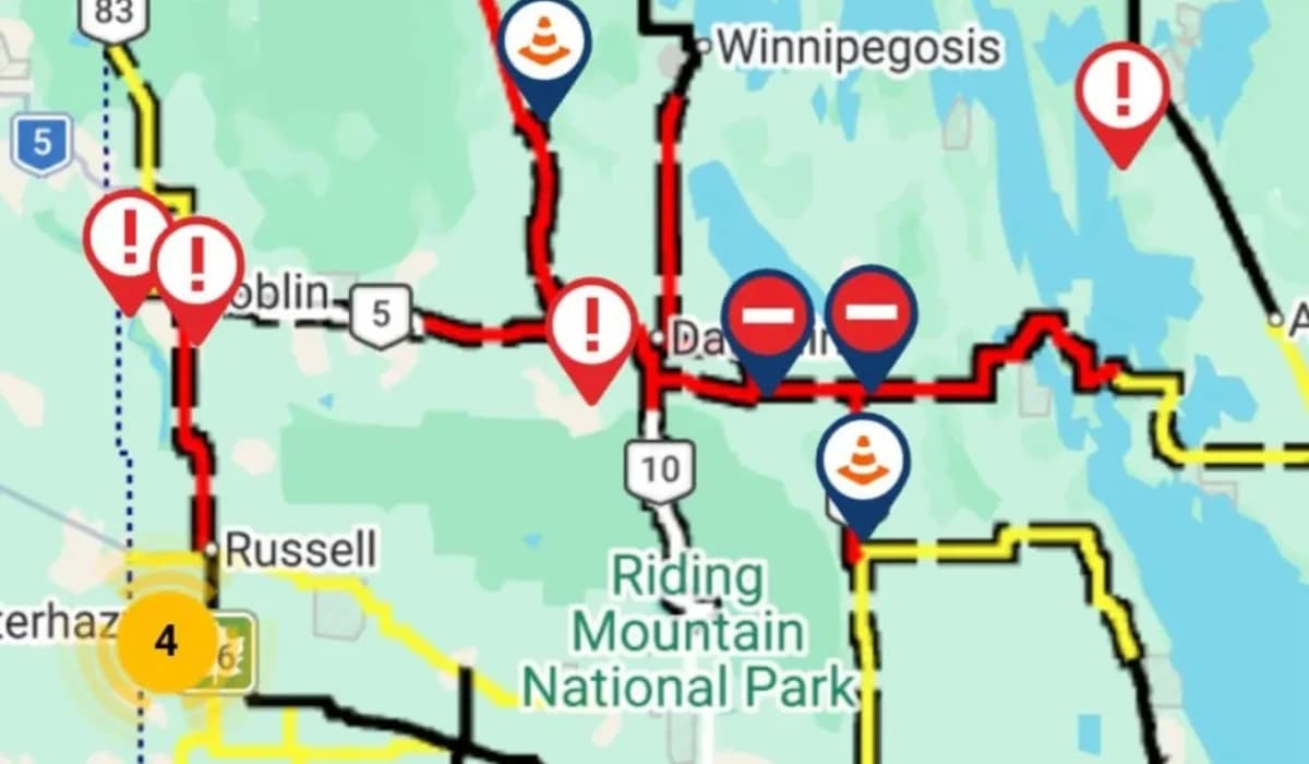
According to Environment Canada, a large portion of the province—especially northern regions—is now under an Orange Winter Storm Watch, as forecasters warn of a high-impact system that could disrupt travel and daily life.
The storm is expected to begin moving into central Manitoba late Wednesday evening, gradually spreading northeast through Thursday. Early stages of the system will bring a mix of precipitation, including rain and freezing rain, particularly in areas stretching from The Pas and Flin Flon east toward the Ontario border.
These regions are expected to experience periods of rain, freezing rain, and snow between Wednesday and Friday. Forecasters indicate that some areas could receive between 5 to 10 millimetres of rain or freezing rain before temperatures drop further, causing precipitation to transition fully into snow by Friday evening. This shift is expected to create icy surfaces, increasing the risk of dangerous travel conditions.
Meteorologists warn that if heavier snowfall develops behind the initial wave of freezing rain, current warnings could be upgraded to full winter storm warnings. The combination of ice accumulation and subsequent snowfall raises concerns about infrastructure impacts, including the possibility of prolonged power outages due to the added weight on power lines and tree branches.
Further north, the storm is expected to intensify significantly. Snowfall is forecast to begin Thursday, developing from south to north, including areas around Cranberry Portage and expanding across much of northern Manitoba. The system is expected to persist through Saturday afternoon, delivering consistent and at times heavy snowfall.
Total snow accumulation in these northern regions is projected to reach between 30 and 50 centimetres. Communities just south of Hudson Bay, including areas near Churchill, are expected to be among those most affected by the heaviest snowfall totals.
Officials caution that the prolonged nature of the storm could result in significant disruptions. Roads and highways may become difficult to navigate due to snow accumulation and icy conditions, with some routes potentially becoming impassable at times. Travel delays and cancellations are likely, particularly in northern and remote areas.
Residents are being advised to monitor weather updates closely, prepare for rapidly changing conditions, and avoid unnecessary travel during peak storm periods. Emergency preparedness, including ensuring access to essential supplies and backup plans for power outages, is also recommended.
While spring conditions have begun to emerge in parts of the province, this storm serves as a reminder that winter weather can still return with force across Manitoba.